
Cargando...
Atopa
visualización

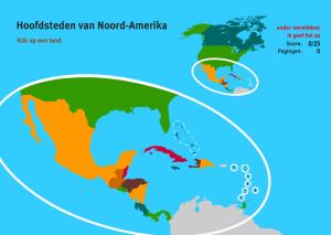
Kennst du die Namen der geographischen Objekte auf der Karte? Test du dich selbst mit dieser interaktiven Karte. Du hast die richtige Antwort aus einer Liste mit mehreren Optionen wählen.Es un mapa de ...
Train je brein met topografie.Es un mapa de la colección EastDock Media.
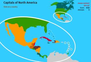
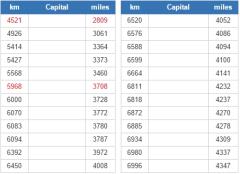
Do you know the name of each capital city shown on the map? Test yourself with this interactive map. You have to choose the right answer from a list with several possible options.Es un mapa de la cole ...
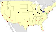
See if you can correctly guess each highlighted American city.
It is an educational content by JetPunk, site that contains a wide variety of quizzes.
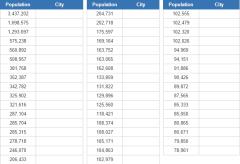
How many of America's biggest cities you can name, based on the 1900 census?
It is an educational content by JetPunk, site that contains a wide variety of quizzes.
What are national capital cities are closest to Anchorage, Alaska?
It is an educational content by JetPunk, site that contains a wide variety of quizzes.
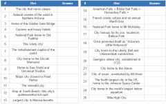
This is a list with the 25 best places to visit in the USA. How many can you identify?
It is an educational content by JetPunk, site that contains a wide variety of quizzes.
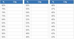
Guess the U.S. cities that have the highest percentage of African Americans. Among cities with a total population above 100,000. Source: 2012 American Community Survey.
It is an educational content by ...
Engadir a Didactalia Arrastra el botón a la barra de marcadores del navegador y comparte tus contenidos preferidos. Más info...


